
World Atlas
World Atlas >

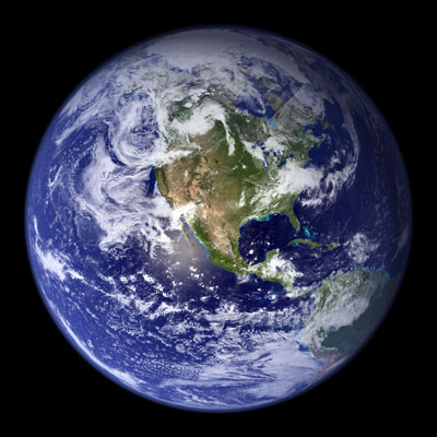
 A world atlas contains information about geography in a variety of map
formats. These maps contain information, both on a global scale and
on a more local scale. Charts that depict earth's hemispheres
show continents, oceans, currents, latitude & longitude lines, winds,
and other data. Local maps vary in their degree of detail; some
only show a country's states and major cities, while others show more
detailed information such as highway & road infrastructures, towns,
rivers, railroads, airports, and parks.
A world atlas contains information about geography in a variety of map
formats. These maps contain information, both on a global scale and
on a more local scale. Charts that depict earth's hemispheres
show continents, oceans, currents, latitude & longitude lines, winds,
and other data. Local maps vary in their degree of detail; some
only show a country's states and major cities, while others show more
detailed information such as highway & road infrastructures, towns,
rivers, railroads, airports, and parks.
 Other maps contain natural geographic landmarks such as mountain ranges,
rivers, lakes, shorelines, and islands. Maps of this type can be
topographical, or they may incorporate satellite photography. These
maps contain data from a wide variety of sources ranging from government
agencies such as the U.S. Geological Survey and other international
agencies as well as from the private sector. Some charts may also
be included that depict oceanographic data such as depth, currents, and
other useful navigational data. These may be used for expeditions,
recreational activities, or for programming GPS receivers. Some
land charts include data on natural resources that may be referenced for
a wide variety of business and industry needs. Special maps for
aeronautical, recreational vehicle, and other specialized needs require
researching alternative sources such as local and national governmental
agencies, business sources, and proprietary software companies.
Other maps contain natural geographic landmarks such as mountain ranges,
rivers, lakes, shorelines, and islands. Maps of this type can be
topographical, or they may incorporate satellite photography. These
maps contain data from a wide variety of sources ranging from government
agencies such as the U.S. Geological Survey and other international
agencies as well as from the private sector. Some charts may also
be included that depict oceanographic data such as depth, currents, and
other useful navigational data. These may be used for expeditions,
recreational activities, or for programming GPS receivers. Some
land charts include data on natural resources that may be referenced for
a wide variety of business and industry needs. Special maps for
aeronautical, recreational vehicle, and other specialized needs require
researching alternative sources such as local and national governmental
agencies, business sources, and proprietary software companies.
World atlases usually include statistical and government information such as capitals, flags, populations, climates, economies, and crops. This data is especially useful for personal, educational, and business studies when presented in an easily understood, graphical format. Research to plot trends in the areas of population growth, climate, and economics can be accomplished by studying and comparing different year editions. These comprehensive reference guides have traditionally been available in print format, but user-friendly information about the oceans, continents and countries of planet Earth is also available online.
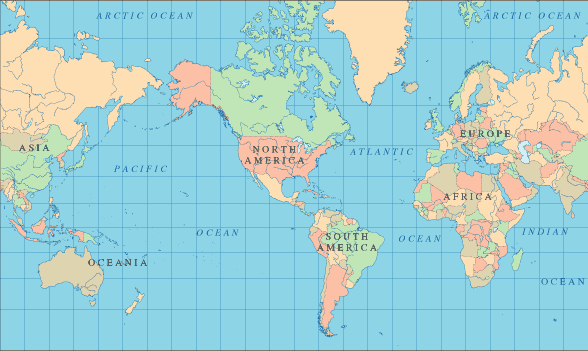 World Map - Mercator Projection
 World Map with Ocean Floor Topography
A detailed map of the world, with countries identified by two-letter country codes, can be found on this world map page.
Interactive World Map
Bibliography
- Cheers, G., Publisher (2004). Geographica: The Complete Illustrated Atlas of the World. Milsons Point, NSW Australia: Random House Australia.
- Collins (2005). Collins Discovery World Atlas (Smithsonian). London: Harper Collins Publishers.
- Espenshade, E. B., Editor (1990). Goode's World Atlas. Chicago, New York, and San Francisco: Rand McNally.
- Philip's (2007). World Atlas and Encyclopedia. New York: Random House.
Online World Atlas Sites
- CIA World Fact Book - reference maps and country profiles.
- HRW World Atlas - relief maps and country statistics.
- National Geographic Mapmaker - interactive map-making tool.
- United States Atlas - state maps and travel information.
All rights reserved.
World-Atlas.us is a Chosen Sites™ reference source. About Us.