South America Maps
World Atlas >

North America
| South America
 South America is the 4th largest continent on Earth. It comprises 12
countries on the mainland as well as several Caribbean Island nations.
South America covers 6,890,000 square miles (17,840,000 square kilometers),
which is almost 3.5% of the Earth's surface.
Like North America, South America is named for Amerigo Vaspucci, an Italian cartographer who was the first to suggest that the Americas were a new land, not part of the East Indies.
South America is home to many of the world's extremes. They include: Angel Falls, the highest waterfall; the Amazon River, the largest river in terms of volume; the Andes, the longest mountain range; Atacama, the driest desert; and the Amazon Rainforest, the largest rainforest. South America also includes the world's southernmost city, Puerto Toro in Chile.
 The Amazon Basin is where the Amazon River flows and the Amazon Rainforest
thrives. This large area covers nearly one-third of South America.
The basin receives approximately 100 inches of precipitation each year, and
rain falls nearly 200 out of every 365 days. The moisture-rich basin is
home to several unique animals and plants that are not found anywhere else.
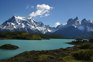
On the other side of the continent sit the Andes Mountains. They run the entire length of South America, from the tip of Chile to Panama. The mountains cover more than 4,500 mi. (7,240 km.). The range is home to several large volcanoes and peaks that reach above 20,000 ft. The highest point is Acocagua, Argentina. It reaches 22,384 ft. (6,960 m.).
The barren Atacama Desert is fairly small, measuring only 625 miles long and 100 miles wide. This area, high in the Chilean Andes, rarely sees rain.
South America is also home to the Brazilian and Guiana Highlands, the Llanos, the Pampas, and Patagonia. The most striking of these is the barren, but very beautiful, land of Patagonia, which is located in Argentina, between the Atlantic Ocean and the Andes Mountains.
Visitors travel to South America to study the pristine Galapagos Islands, where many rare and unique animal and plant species are found. They come to take in festivals, like Carnival in Brazil, and to see unique sites like the San Marcos Cathedral in Chile.
South America Map

Interactive South America Map
South American Countries
The table below lists the countries of South America and their capital cities, and also features convenient links to maps and detailed information about each South American country.
| South American Countries And Capitals | |
|---|---|
| Country Name | Capital City |
| Argentina | Buenos Aires |
| Bolivia | La Paz/Sucre |
| Brazil | Brasilia |
| Chile | Santiago |
| Colombia | Bogota |
| Ecuador | Quito |
| Guyana | Georgetown |
| Paraguay | Asuncion |
| Peru | Lima |
| Suriname | Paramaribo |
| Uruguay | Montevideo |
| Venezuela | Caracas |
See the CIA World Factbook home page for information about this helpful geopolitical resource, and visit this map of South America website for more South America maps and South American travel information.
World-Atlas.us is a Chosen Sites™ reference source.
To facilitate browsing, certain links will open in new windows.